Home / Plot finder
Find the plot nobody has listed.
The plot finder looks for gardens, gap sites and small parcels that could take a new home, then checks each one against the local plan. Built by Staniforth Architects for owners, self-builders and small builders.
Four kinds of plot
Garden plots
Large gardens where a new home could sit, measured from public mapping.
Gap sites
Gaps in a built-up frontage, the classic infill plot.
Land off lanes
Back land and paddocks with a road or track to them.
Yards and car parks
Hard-standing and small yards that may suit a home or two.
A first view, with the reasons
Every site gets the same checks, drawn from public data. You see the rules behind the score, not just a number.
- Size, shape and road frontage from public mapping
- Whether the site sits inside a settlement's planning limits
- Constraints such as flood zones and conservation areas
- A score with the planning rules behind it written out
- Sold prices for homes nearby from HM Land Registry, with the source
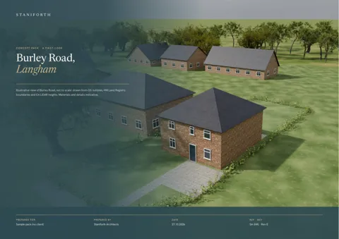
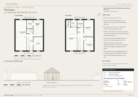
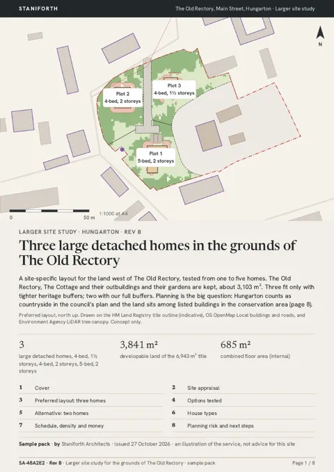
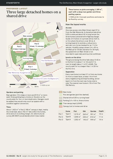
Plot concepts, drawn by architects
When a plot looks promising, order a concept showing what one home, or a small group, could look like. These pages are from sample reports.
Where the plot finder works
Each area page covers the local plan, the council's self-build register and how to join it.
Demand for plots outruns supply
- 64,851 individuals were on self-build registers in England at 30 October 2024.Source: GOV.UK, Self-build and custom housebuilding data (released 5 September 2025)
- 4,302 planning permissions were granted for serviced plots suitable for self and custom build in 2023–24, 18% fewer than the year before.Source: GOV.UK, Self-build and custom housebuilding data (released 5 September 2025)
Plot finder FAQ
What does the plot finder find?
Possible building plots: large gardens, gaps in a frontage, land off lanes and small yards. Each one is found from public maps and planning data, then scored against the local planning rules.
Are these plots for sale?
Not necessarily. The plot finder finds sites that could take a new home. It does not list property for sale, and the owner may not want to sell. Many of our users are owners checking their own land.
Does a good score mean planning permission?
No. The score is a first view based on public data and the local plan. Only the council can grant planning permission, and every site needs a proper check before anyone spends money.
Where does the data come from?
Public sources: OpenStreetMap mapping, LiDAR height data, flood and conservation-area maps, council local plans, and HM Land Registry sold prices.
Why do I need to sign in to see the sites?
Sites are on private land, so their locations stay behind sign-in. This page and the area pages only use public information.
Which areas are covered?
Rutland, Melton, Harborough, Rushcliffe, Newark and Sherwood, Bassetlaw, Nottingham, Stamford in South Kesteven, Richmond upon Thames and the Harrogate district in North Yorkshire. See the area pages below.
What is the self-build register?
Every council in England must keep a register of people who want a plot to build their own home. Joining tells the council there is demand. GOV.UK publishes the national figures.
See the plots near you
Sign in to open the map, see each site's score and order a report.
Sign in